-
Apparel
- All Apparel
-
Women's
-
Lifestyle
-
Brands
- Our Blog
- Gift Cards
Slideshow Items
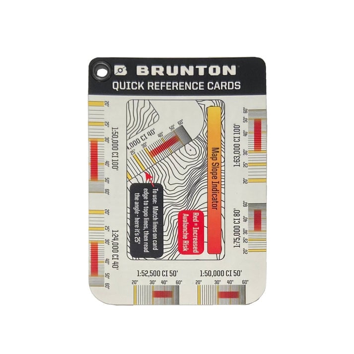
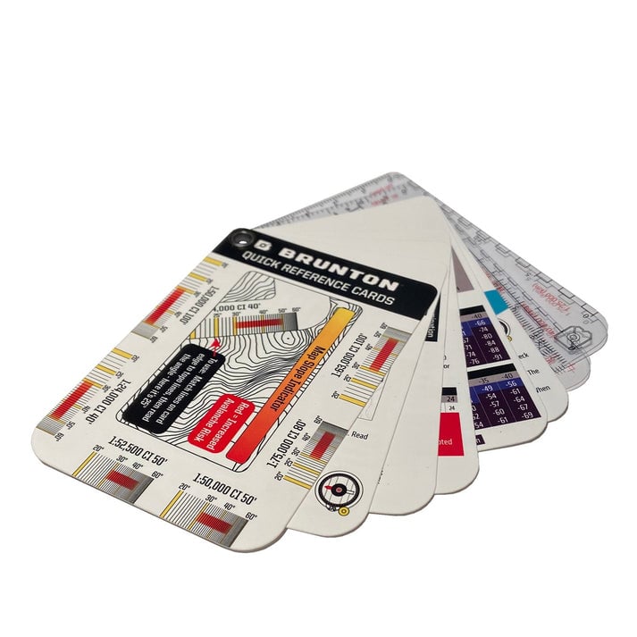
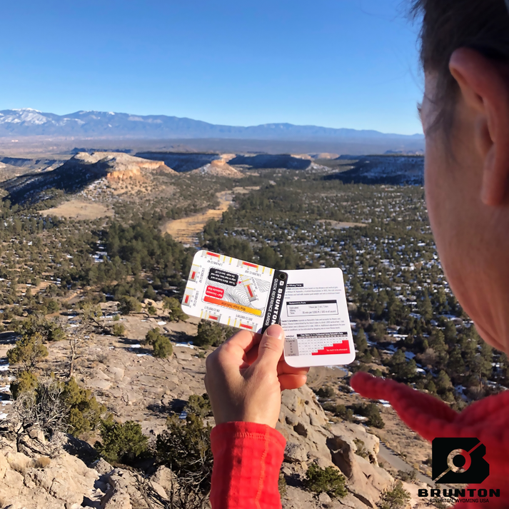
Map tools, navigation tricks, and outdoor safety tips all in one handy card set!
As experts in the navigation field, Brunton created this lightweight and durable reference card set that can help you better explore, whether in the front-country or backcountry.
This set was created to be used with any map and compass and also stows neatly in the rubber foot of the TruArc 20 (not included). They contain essential references and tips and techniques for efficient and safe wilderness travel. Our cards can help you calculate and determine distance, location, and slope on a variety of topo maps and will give you many of the basic tools and concepts that can help you make better decisions outdoors.
• Waterproof, durable, and lightweight cards can handle exposure to any type of weather.
Reference cards include:
• Map Slope Indicator Scale (works with both metric and standard map scales)
• How to Orient a map to true north
• Taking a map bearing
• Sighting a field bearing
• Travel a compass bearing
• Triangulating a location
• How to use Romer Scales
• Suggestions when you are lost
• Water tips
• Common knots
• Calculating hike times
• Metric and Standard Topo Buddy scale cards
• DIMENSIONS: 2.5 x 3.7 x 0.06 in | 6.4 x 9.3 x 0.2 cm
• WEIGHT: 0.5 oz | 12 g
• COMPASS NOT INCLUDED
Carousel items
You cart is currently empty